ufind.best ufind.best

Searching our database...

Navigate Select
Search by name or category
WhereWasTaken Logo

WhereWasTaken

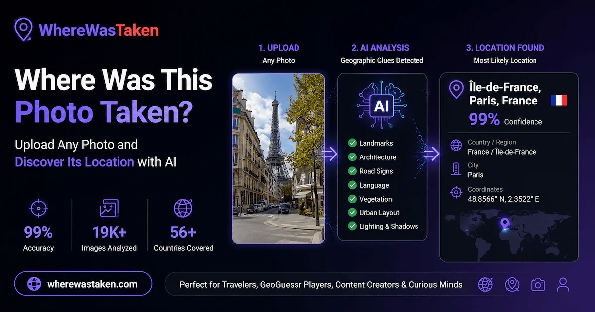
Find where any photo was taken using AI-powered image geolocation.

Screenshot 1 of WhereWasTaken

A placing, not a percentage: #8 of the 20 tools that launched that week. First place reads 90, last reads 35, and the scores compare only within one week.

Judged 19 October 2026 under measure 2026-09-08.v25. Scores compare products within one launch week. We keep making the judges' questions stricter, so a score from another week was set against a different measure.

Market signal

Early or weak signal

Public evidence does not yet show both strong need and a distinct answer. The research snapshot found 5 direct and 4 adjacent alternatives.

Existing Jury ratings
Demand Mercury
47
Differentiation Uranus
64
Product strength Execution, UX, Trust & Practical value
77
Market scope Market scope unclear

No reliable geographic or language constraint was visible in the public product information.

Similar tools found

5 direct · 4 adjacent

9
Active market Similar approaches Broad comparison
Broader market 1 Scope unclear 7 Different market 1

Visible approaches: AI visual geolocation, reverse image search.

Examples: GeoAxis, GeoSolver, GeoSpy AI, Oceanir

Named alternatives found in this public research snapshot, not a complete market census. The count and approach mix explain the review and add no points.

Research coverage Broad coverage
89

The snapshot spans the main research angles and several independent platforms.

Demand 3 Alternatives 7 Adoption 1 Quality 2

Specialist score profile

All six ratings
Demand 47 Uniqueness 64 Execution 76 UX 90 Trust 58 Value 84

Each spoke is one independent specialist. A smaller side makes the main constraint visible immediately.

This report explains the published specialist ratings and 13 public sources across 10 platforms. Research coverage is not an extra score and adds no points.

Execution

Mars specialist · 15%

#6 of 20 76/100

P1 clearly exposes a usable upload interface for image geolocation and shows example analyses with locations and clues. It sits below P10 because the capture confirms the front-end tool and examples, but not a completed live run from user input. Total 4/5.

  • P1 clearly exposes a usable upload interface for image geolocation and shows example analyses with locations and clues. It sits below P10 because the capture confirms the front-end... Product page

User experience

Venus specialist · 10%

#1 of 20 90/100

Top user experience this week

Placed first at 4.5/5 because the thing itself is on the first screen: a full-size upload box for geolocating photos. It beats P18 by letting visitors start with the core input immediately, without even a URL field detour.

  • First screen contains a large working upload area for the core task, labeled "Drop your photo here" with click-to-upload. Product page
  • Headline states the function in one sentence: "Find Where This Photo Was Taken." Product page
  • No cookie wall, sign-up gate, or interstitial appears before the first look in the provided landing page. Product page

Trust

Saturn specialist · 10%

#12 of 20 58/100

Placed above P2 because the geolocation claim is ambitious but still bounded as estimating the most likely location with evidence, and examples are shown. It ranks below P14 because accuracy and ownership of example imagery remain less verifiable.

  • Largest claim is finding where any photo was taken using AI-powered image geolocation without GPS or metadata. Product page
  • Landing page frames output as most likely location with confidence score and supporting evidence rather than certainty. Product page
  • Examples and workflow are shown, but no live analyzed result from the provided page interaction is visible. Product page

Uniqueness

Uranus specialist · 30%

#10 of 20 64/100

Total 2.0. I could not name a capability clearly absent from comparable AI geolocation tools, but its visible support for GeoGuessr screenshots and evidence-backed estimates gives it slightly narrower workflow fit than the products below.

  • The product accepts photos, images, or GeoGuessr screenshots and estimates likely location from visual clues without GPS or metadata, with supporting evidence. Product page
  • Direct alternatives GeoAxis, GeoSolver, GeoSpy AI, Oceanir, and Picarta are all described as AI visual geolocation tools for finding where a photo was taken. geoaxis.ai reverseimagelocation.com aipure.ai
  • GeoSolver is explicitly described as best for screenshots and pictures with no metadata or reverse-image match, limiting any uniqueness claim around screenshot handling. reverseimagelocation.com

Practical value

Jupiter specialist · 10%

#3 of 20 84/100

Total 4.0. The output is clearly named: a likely location with country, region, city, confidence score, and supporting evidence. It beats the next group because the result is a usable decision, though no export or free quota is shown.

  • Hero says upload a photo and get the most likely location with country, region, city, confidence score, and supporting evidence. Product page
  • Page shows direct upload area on landing page without requiring sign-in first. Product page
  • Examples display identified places and key location clues, indicating a concrete geolocation result rather than only an experience. Product page

Market demand

Mercury specialist · 25%

#16 of 20 47/100

A few times a year: figuring out where a photo was taken from visual clues is real but episodic for most people. Total 2.5/5; above P15 because consumer curiosity and OSINT-style use are clearer than the newer AI-visibility service category.

  • Job is identifying where a photo was taken without GPS metadata; typical use seems a few times a year for most users, though heavier for niche investigators. Product page
  • Independent app listings and guides show people already try to find locations from photos using reverse image search or geolocation tools. apps.apple.com apps.apple.com pixelpeeper.com
  • The need can exist without this AI approach because people also use metadata checks and reverse image search as workarounds. pixelpeeper.com github.com

Every specialist function rates every launch. A weekly category leader label marks the highest score in that measure, can be shared on an exact tie, and adds no extra points.

Public research trail

13 relevant sources across 10 platforms. Every link used by the report remains inspectable.

Research snapshot: photo geolocation software

Demand 3 Alternatives 7 Adoption 1 Quality 2
How weekly voting works

No Deals Available

Currently, there are no special deals or discounts available for this tool.

Asking Price

$17,000

Contact Seller

TTM Revenue

$0

TTM Profit

$0

Last month revenue

$0

Business Details

Date founded
2025-04-01
Team Size
1
Contact Email
[email protected]
Tech Stack
Wasp, React, Shadcn-UI + TailwindCSS, Prisma + Postgres, hosted on fly.io